Covering Queens in Art, Top to Bottom

More and more people are discovering that the city's fastest growing art scene isn't in Manhattan... it's in Queens. The waterfront neighborhoods around Long Island City have a growing number of art galleries and co-working spaces. They also an impressive collection of museums: MoMA PS1, the Sculpture Center, The Noguchi Museum, Socrates Sculpture Park, & more. And in the warmer months, you can also stop by the popular LIC Food & Flea festival, and catch the views from the waterfront parks.

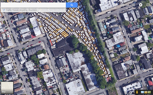
But Long Island City (or, LIC) has always been synonymous with street art. The neighborhood once housed the the world's premiere “graffiti Mecca”: 5Pointz... aka, The Institute of Higher Burnin', aka 5Pointz Aerosol Art Center. Artists from all over the world would apply for a chance to paint on this site. The building itself, while huge (200,000-sq-ft/19,000-m2!), was not itself otherwise remarkable. It was simply a privately-owned factory building that the owner had converted inside to rented artist studios, and turned on the outside to a heavily-curated graffiti gallery. (And curated it was: artists would have to submit portfolios/samples for a chance to make their mark on its walls)

Most New Yorkers became familiar with it while riding the 7 train, as the massive complex, and its painted walls, was the first thing one would see as the train came above ground in Queens.

The building was even featured in TV & movies, such as the climax of the 2013 film, "Now You See Me".

The building was even featured in TV & movies, such as the climax of the 2013 film, "Now You See Me".

Alas, the growing popularity of Long Island City ultimately sealed 5Pointz's fate. The building's owner was made a generous offer for the land by developers, and he sold. After a failed effort by artists to have the building landmarked, it was demolished. A large, luxury residential complex is currently going up where it once stood. Some 5Pointz-era street art on the other end of Davis St is all that remains of the former mecca.
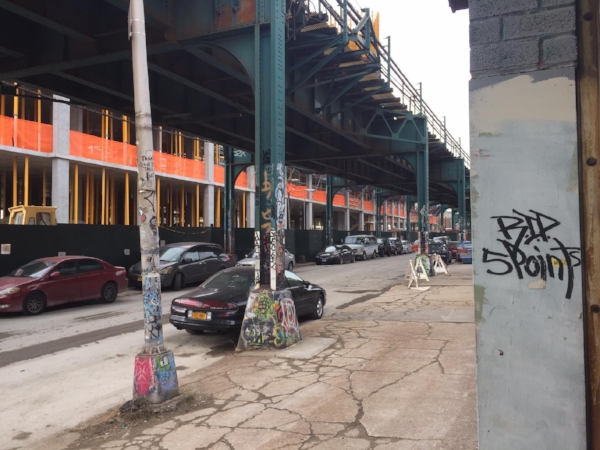
RIP.

RIP.

Today, the NYC street art community has largely splintered, with efforts centered around new areas like Bushwick or the Lower East Side or Welling Court in Astoria.

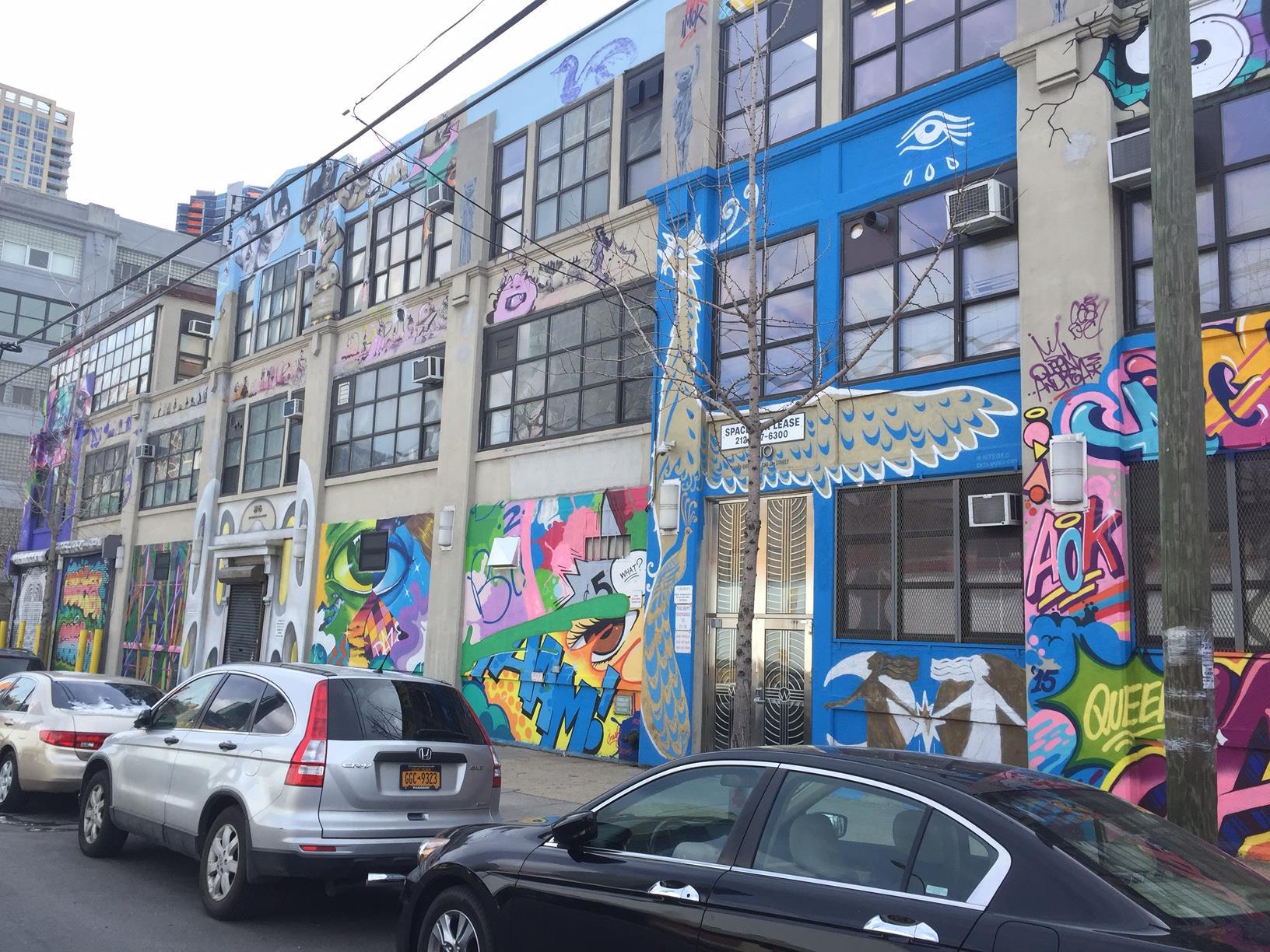
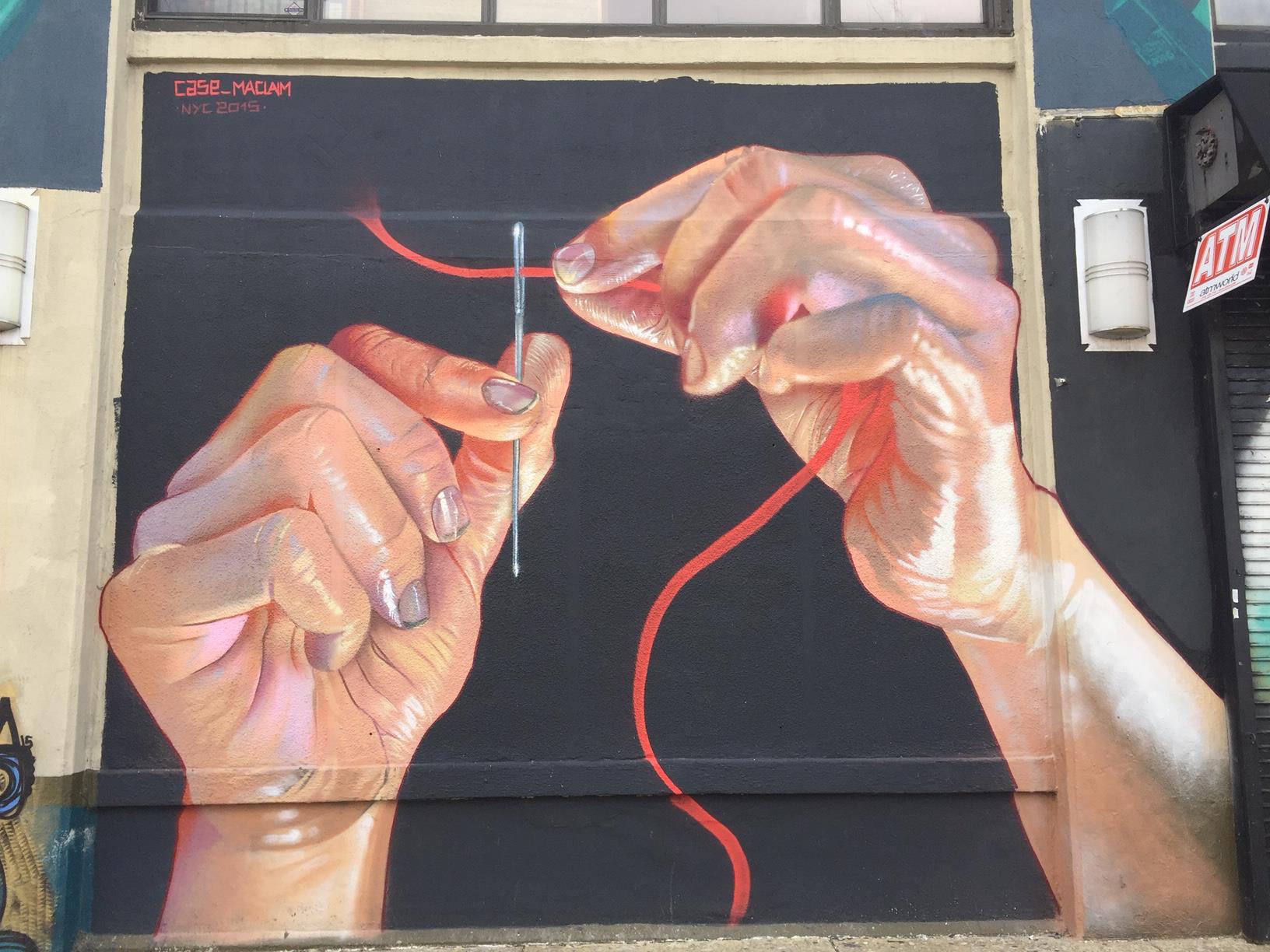
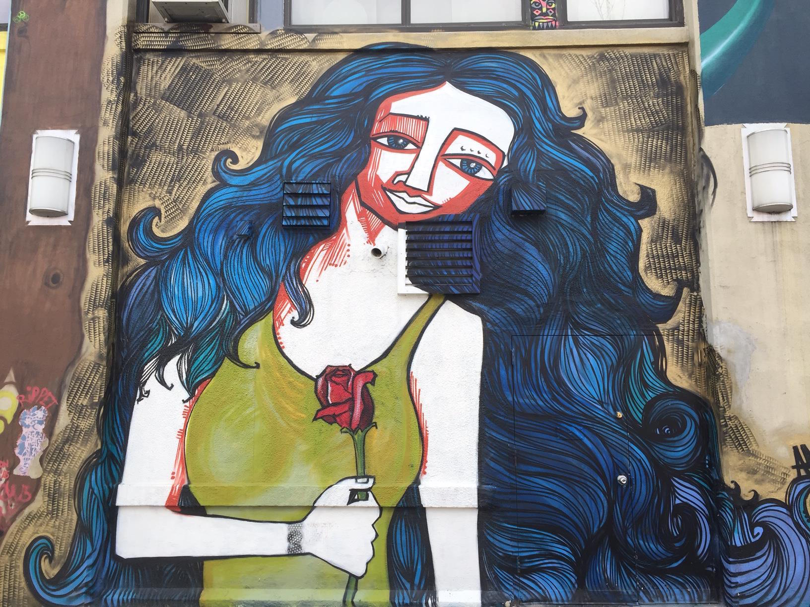
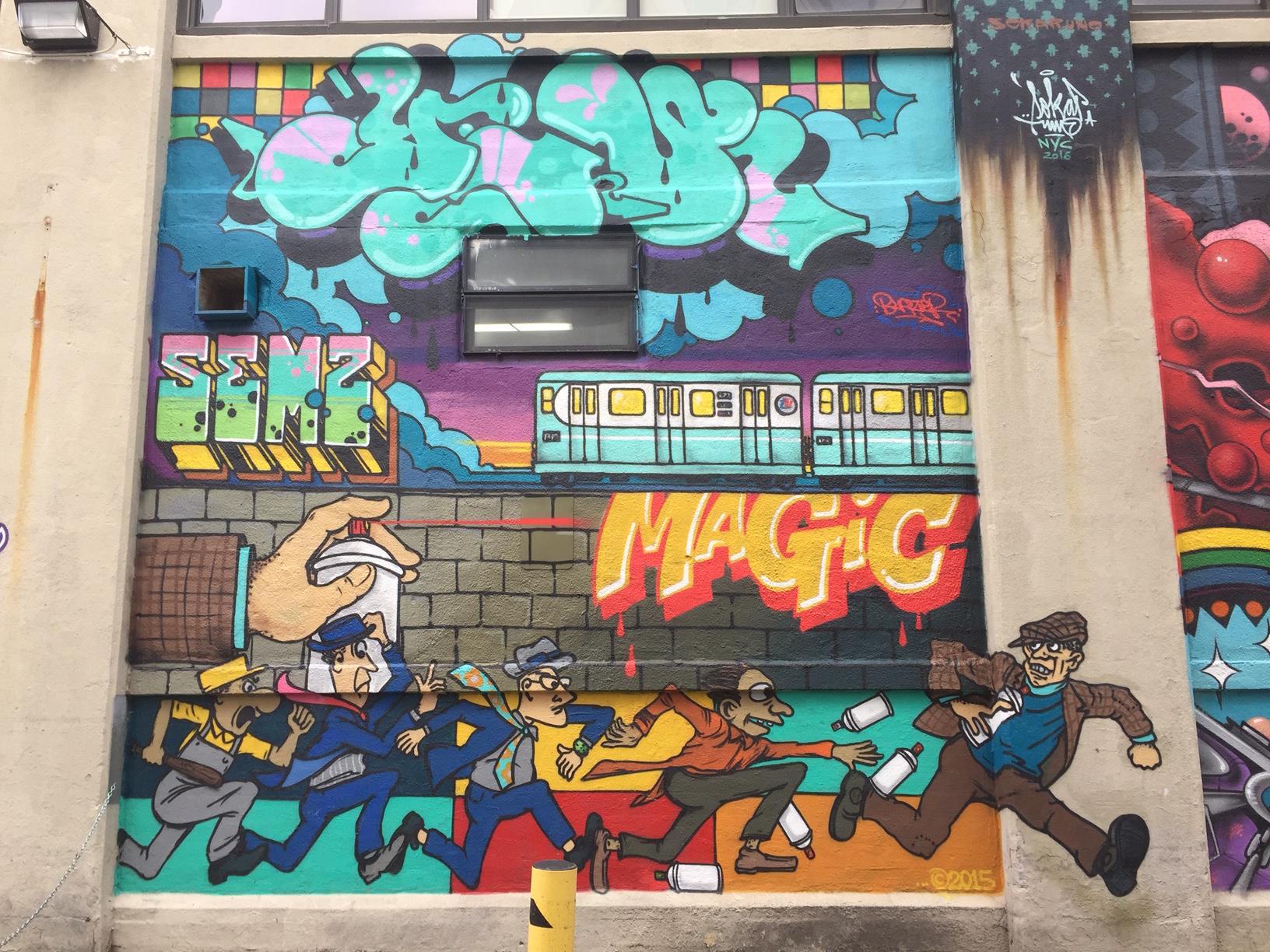
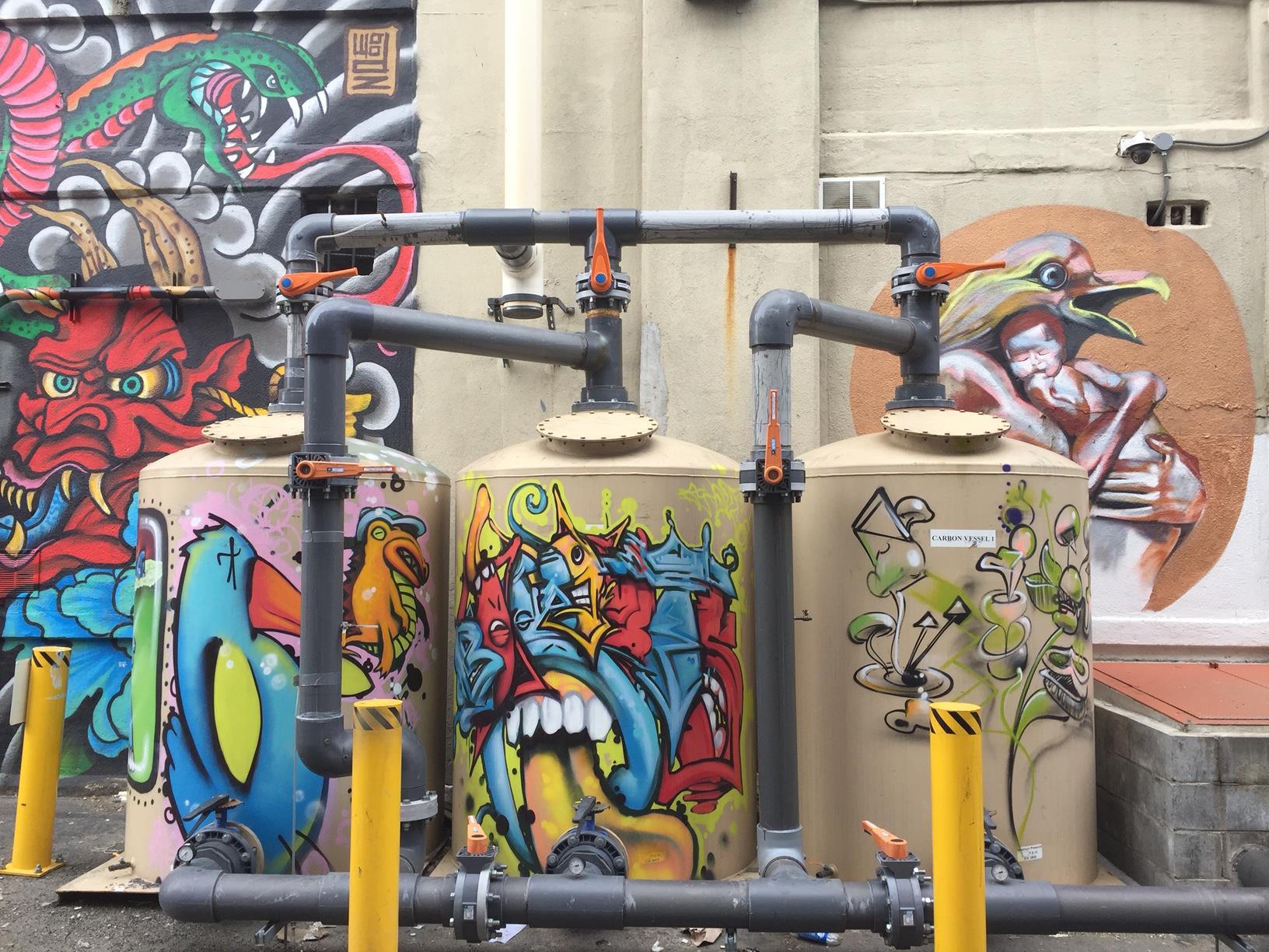
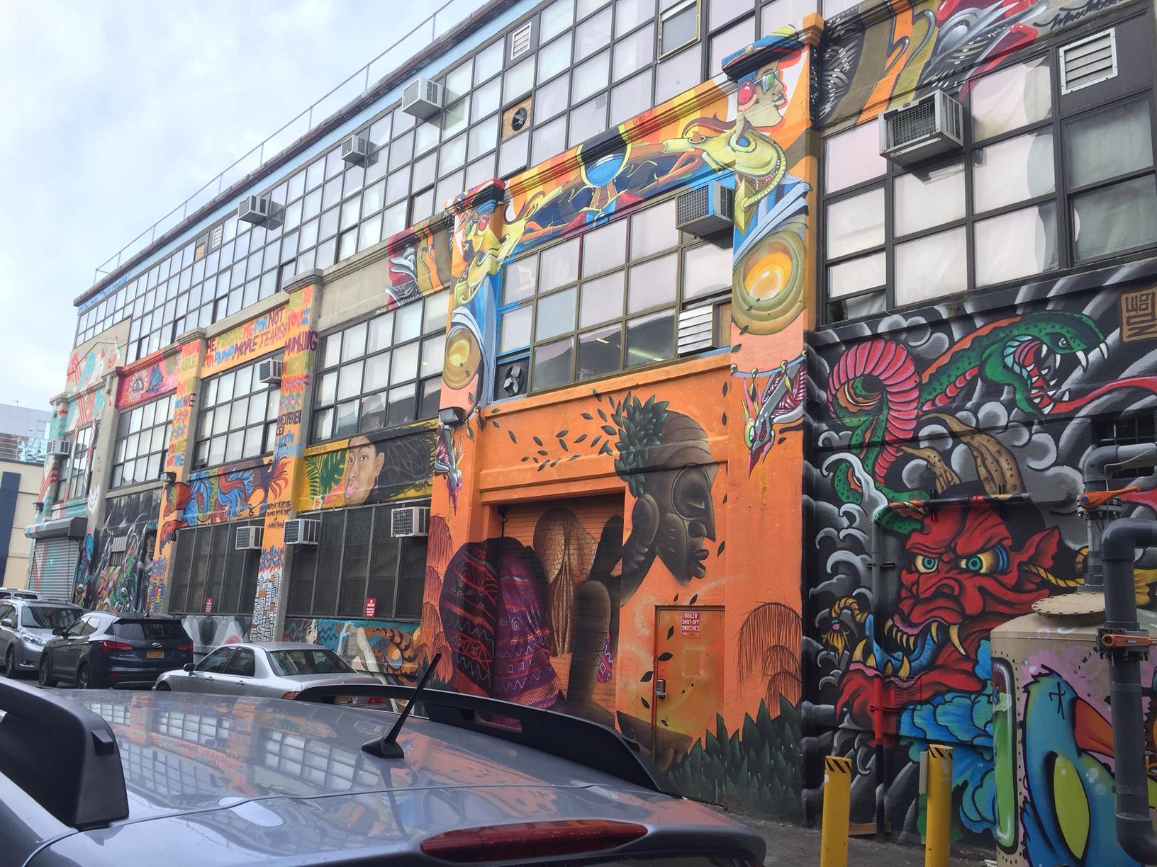
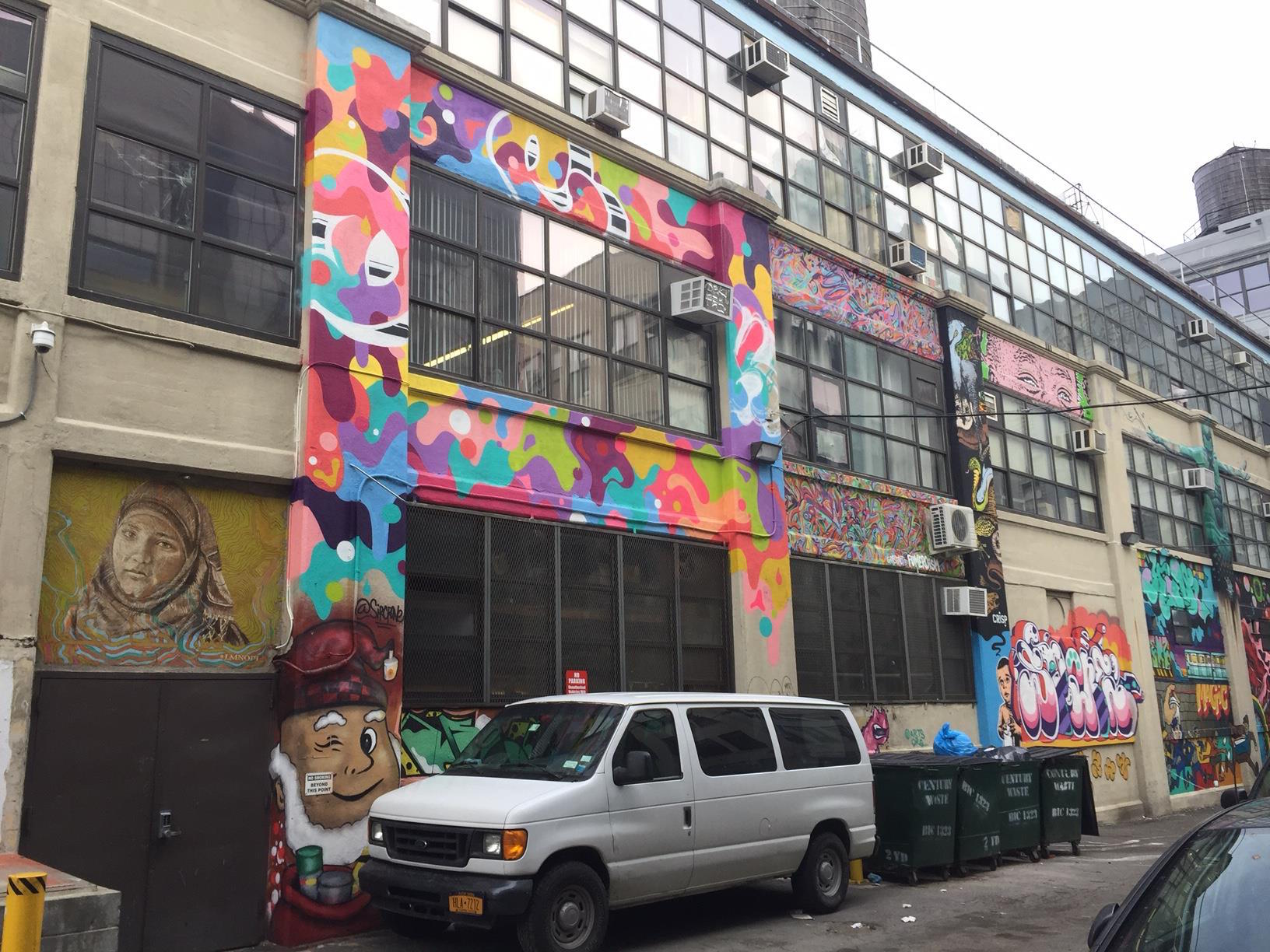
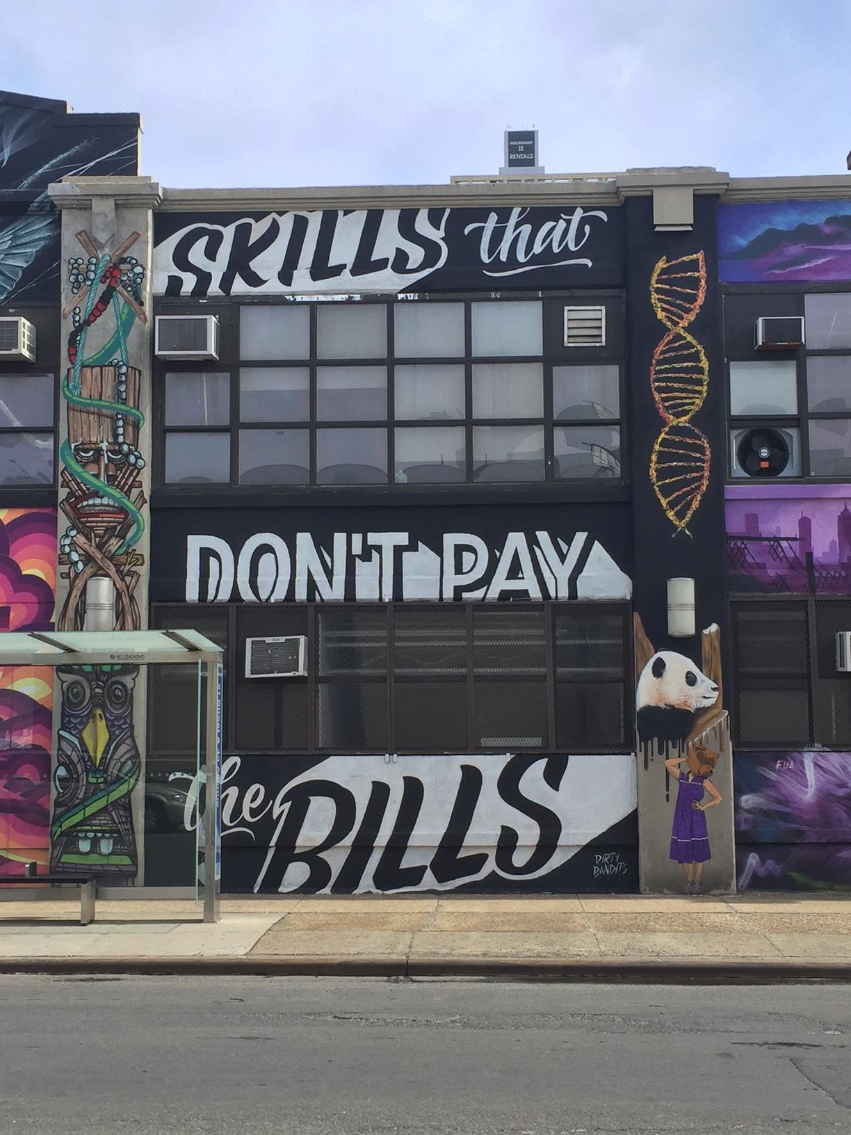
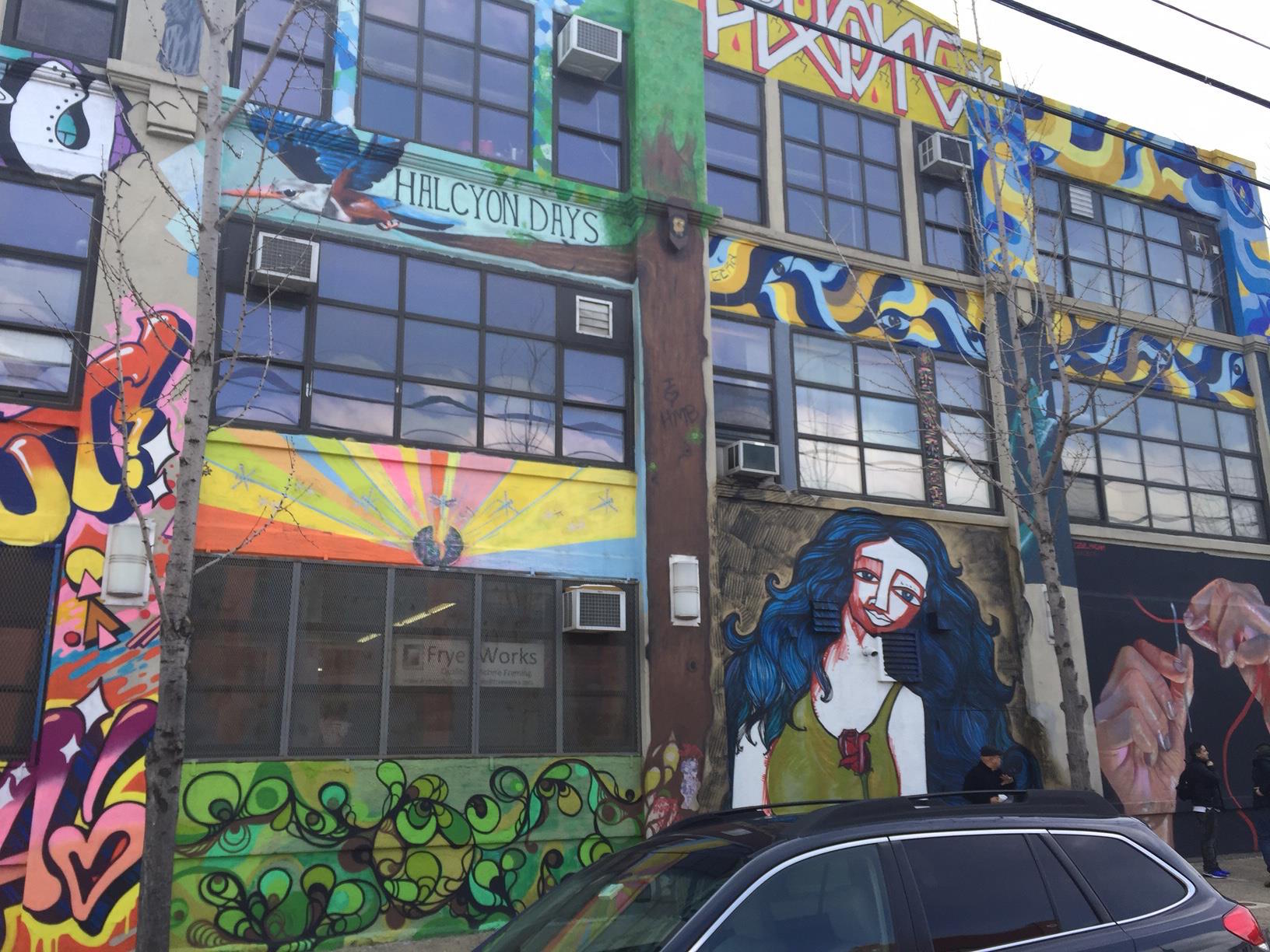
But one organization is looking to create a new mecca nearby in LIC. Arts Org NYC is a group that has worked on numerous projects. Their main project now is called "Top to Bottom", centered at a huge building at the intersection of 21st St & 43rd Ave, just a 10-minute walk from where 5Pointz once stood. The project was recently spotlighted on The Huffington Post.  They have gathered some very popular street artists to cover their building from, you guessed it, top to bottom with gorgeous and fun murals. “It’s just a beginning,” creative director James P. Quinn said.

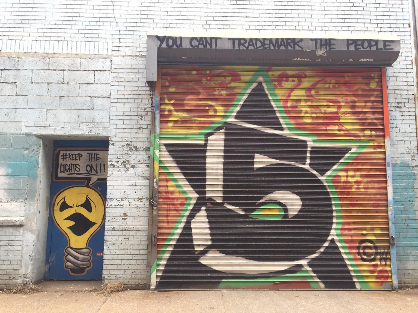
I visited the site today, and was so happy to see that street art in LIC is still thriving. It inspired me to do something I've been thinking about for a while... create a tour of Long Island City, focused around its street art scene. That will be added to this site very soon. I love this neighborhood in general, and think it's a great way to introduce people to the very underrated borough of Queens.

Here is a slideshow of some of my photos from today's exploration.

Know anyone interested in this type of tour? Please spread the word!

Come On Down To The World's Fair!

I'm excited to be soon offering even more dates for my World's Fair history of Flushing-Meadows, in Queens. I've written about this tour before-- such as my recent post on the Fair's connections to the Disney theme park empire-- as it is a favorite of mine to lead. And it's a perfect time to visit... due to the warm winter, I already saw cherry blossoms in early bloom there yesterday!

Flushing Meadows-Corona Park is actually larger in size than Central Park (fact: the latter is actually only the city's fifth-largest park). It sits on a former dumping ground, which was derided as "a valley of ashes" in F. Scott Fitzgerald's 'The Great Gatsby'. The land was cleared and turned into park-land by famous city planner Robert Moses to become the site of the 1939 World's Fair (which was a hit with crowds, but a financial failure). There is only one building remaining from that Fair... which later became the first headquarters for the United Nations, was re-purposed for the 1964 Fair, and currently houses the Queens Museum. That museum still houses an exhibit from 1964 (since updated)... the popular Panorama of the City of New York, which depicts all of the buildings in the entire city in 1:1200 scale. It must be seen to be believed. We see all of this on my tour.

(It is this park that, of course, hosts the annual US Open tennis tournament.)

On this tour, we also pass the following World's Fair artifacts & landmarks: the iconic Unisphere, the New York State Pavilion, a time capsule, numerous statues, Rocket Park, old streets and water fountains,  a Jordanian marble column which dates back to 120 AD, and much more.

Learn how these two Fairs reflected the times they were in, while looking to the future, and how they re-shaped New York City as a whole for years to come.

I will provide images & stories from the past....

....While we tour its present and learn of its future:

I believe this is a fun & easy tour for visitors of all ages... whether you visited the World's Fair, and want to re-live those memories, or you are young and want to discover what Queens has to offer.

Interested? Contact me!

QueensWay, or No Way?

Many people in NYC (okay, just central Queens) are familiar with the long-abandoned Rockaway Beach Branch of the Long Island Rail Road (LIRR), an amazing stretch of track that runs all the way from Rego Park down to South Ozone Park. It has come into spotlight in recent years due to two competing visions: proposals for a greenway/linear park called the QueensWay-- inspired by the success of urban rail-to-trail projects such as the High Line-- and transit advocates who want some sort of rail rebuilt (varying from LIRR ‘reactivation’ to a massive project of subway conversion involving tunneling under Rego Park and connecting to the Queens Blvd subway line). In the meantime, it is (largely) a forest.

My fascination with it began growing up in South Ozone Park. As the Manhattan-bound A trains neared the Rockaway Blvd station, a large scrap-metal spider could be seen hanging on part of the abandoned line (it has since fallen, and decayed). An image of the spider in its heyday can be seen on an Angelfire site, where you can also scroll through to find images showing the line as it stood around a decade ago. Despite spending most of my life in Queens, I had never set foot on it, however. I since changed that, with several visits in the past few years.

This blog post will be a mix of sharing my own walks and images, along with some subsequent research I did to answer the questions that arose along the way.

First, let’s orient ourselves via map. The following shows you where the northern end broke off from the main LIRR line, shortly before the Forest Hills stop.

I entered the trail near there, right off of Fleet St, where it can be accessed inside a ball field, and I headed south. This end was the most overgrown, and was almost impossible to pass in some areas. Being in shape and limber is recommended (and absolutely not recommended in wet or humid weather conditions).

It wasn’t until I got past Metropolitan Avenue that I hit a big question mark… and a literal dead end.

It was then that I realized that this track was not as 'linear’ as it is often described.

The bridge where the line once crossed the (lower, and still semi-in-use) Lower Montauk LIRR line is completely gone… collapsed, or removed, I could not determine.

Let’s look at this point via (again) map.

I climbed down the hill onto and across the Montauk tracks where you see this:


More questions arose on the other side here, where there was no more track to follow. Beyond the above trestle, there was only a parking lot. Where’d the QueensWay go? 

Just to the (west) side of this lot, however, I found another set of tracks, which curved west toward the Montauk tracks, but from there did head south. Was what we think of as one linear path actually TWO separate lines? Yes, and no.

Just ahead, where the tracks cross over Union Turnpike, it starts to get a little clearer. Here, I found two bridges, where the two lines began to come close (but not yet intersect).

The above image was taken from the bridge of the rail that came from the Montauk tracks looking east at the bridge of the rail that came south from Rego Park. (Make sense?)

Let’s get a overall picture of how this works, via satellite map.

Above, you can see where the “right of way” from the Rego Park line now is gone, and has been taken over by a parking lot, and where the stretch coming from the Montauk line runs adjacent to a small ball field. The two dark red/brown lines over Union Tpke represent the two bridges. Across the western one, the line peters out into a parking lot of an apartment complex.

The “?” I added in the previous satellite map grab shows where the two lines met, and where the rail line picks back up again, at the entrance to Forest Park.

Now let’s a break from my journey to fill in some of these blanks. After I returned home, I looked up the Wikipedia page for the Rockaway Beach Branch, and found my answers. The page notes: “Steam trains continued to serve Rockaway Park from Long Island City [the Montauk line] until June 16, 1910, when the electrified Glendale Cut-off opened, extending the line north from Glendale on the Montauk Division to White Pot Junction at Rego Park on the Main Line.”

So the two lines were together from the Rockaways north to Glendale, where they separated just south of Union Tpke. In short, a lot more complicated than either side discusses in their simplified history of the line.

Back to the journey! 

The section of the park that runs through Forest Park is the smoothest, least forest-y (and most easily accessible) area, and is therefore the one I’d recommend for anyone who wanted to see this, but isn’t up to a deep forest hike.

At the end of Forest Park, over Park Lane South, fencing was put up to block the overpass bridge, but large holes have been cut through by others to make passage easy. Past there is where it starts to get wild again, and where you start to notice, as the Wiki page notes, “A number of properties adjacent to the right-of-way have expanded their property fences over sections of the former right-of-way, without acquiring the rights to the land”. Oop. Close to Atlantic Avenue is where I headed out, as a look further south seemed to indicate further passage would be quite difficult. 

Map-wise, here’s where it runs south of the park.

And with satellite image mode:


(That tree line provides a helpful illustration, no?)

After bailing from the trail, I continued on foot on street level alongside the railway to continue my journey.

(See? Impassable. I’d never to get touch those spider remains.)

Right over here, at Atlantic Avenue, the entrance to the former Atlantic Ave station is fenced off.

Right south of Atlantic, I noticed something curious up there… school buses?

How’d they get there? And how do they get down every day? Once again, the Wiki entry provided my answers: “The line’s connection with the Atlantic Branch at Woodhaven Junction, consisting of an interlocking, tunnel portal and incline that rose to meet the elevated Rockaway Branch, was closed and removed in October 1955. This connection had primarily been used to allow trains from Brooklyn to reach Aqueduct Racetrack. The remains of the interlocking can still be seen in the Atlantic Avenue tunnel, while the incline is now used by Logan School Bus Company, who parks their bus fleet along the incline.”

Here is a link to what remains of that incline.

And here’s what that bus lot looks like via satellite.

Soon after this point, my journey came to an end on Liberty Avenue, where the Rockaway Beach Branch meets up with the Rockaway-bound A line heading south. From Liberty, I was able to capture an image of the spider’s carcass. RIP, little guy.

I hope that this post was able to help shed some light on the Rockaway Beach Branch/QueensWay/etc, which it turns out most people don’t know that much about, myself included prior to these explorations.

Regarding the debate between park versus rail, a few of my personal opinions: I (mostly) side with the park crowd, as I feel that re-drawing Woodhaven Blvd with dedicated bus lanes and adding Select Bus Service could alleviate a lot of transit issues… and could be done in the very near future at (relatively) low cost. With the Second Avenue subway (now in its 9th? decade of planning), East Side Access for LIRR, Fulton Center, etc, the MTA has proved it is no longer capable of doing big ideas remotely on time or in budget. Queens residents can’t pin their transit hopes on a fantasy that this is not the case. Yes, this area could benefit from more rail. But look a subway map of Queens. Most of it is a subway dead zone. This area is less-so than most, actually. And finally, let’s be real… as the Wiki entry notes, most residents don’t want rail in their 'backyards’. Or a park. They want the status quo. NIMBY, literally.

Until you can fight that, the forest remains.

The 1964 World's Fair... Presented by Walt Disney?

One of the unique tours that I offer is a World's Fair history tour in Flushing Meadows-Corona Park, in Queens. Having grown up in Queens, getting visitors to explore this diverse borough is a passion of mine.

This tour also intersects with another passion of mine... Disney and its many theme parks (my travel bucket list: visit every Disney theme park in the world. Halfway there!).

Walt Disney was heavily involved with the 1964-1965 World's Fair, and the legacy of his involvements remains at his theme parks worldwide today. As Disneyland's Tomorrowland (one of the original 4 sections of the park) showed, Disney shared the same obsession with an idealized, scientific future as most Worlds Fairs did. So he was thrilled to be involved. Disney created 4 major attractions for the Fair, and we'll look at each. In addition, like at his own park, costumed Disney characters roamed the Fair grounds.

Walt Disney's parks pioneered the technology of Audio-Animatronics, and he first showcased this at the Fair. For the Illinois pavilion, Disney created an attraction called "Great Moments With Mr. Lincoln", a theater show in which an animatronic Abraham Lincoln recited his famous speeches. This attraction was moved to Disneyland after the Fair, where it still runs today. An expanded version of this concept, the continuously-updated Hall of Presidents, was created for the Disney World resort.

(There were rumors that Disney was seeking to use Flushing Meadows as the sight for his planned East Coast Disneyland, but that was never confirmed, and the cold winters alone likely were a key deterrent, and the cheap land in sunny central Florida won out.)

Animatronics also featured heavily in the most famous Disney creation for the Fair... "Pepsi-Cola Presents Walt Disney's 'It's a Small World' - a Salute to UNICEF and the World's Children". In this attraction, which involved a boat ride, dolls and animals representing countries and cultures from around the world danced and sang to a tune written by Disney's favorite songwriting collaborators, the Sherman Brothers. This too was moved to Disneyland after the Fair, and the ride has been recreated in every Disney resort since. Odds are most of you have ridden it, and now have that song stuck in your head. Sorry about that.

For the General Electric-sponsored Progressland at the Fair, Disney created the "Carousel of Progress", a revolving theater where the audience moved around six stages showcasing the importance of electricity in the home, over several generations. For this show, the Sherman Brothers composed another new song, called 'There's a Great Big Beautiful Tomorrow'. After viewing this show, audiences went to a second level, where they saw Progress City, a small-scale model for Disney's original concept of EPCOT (his  Experimental Prototype Community of Tomorrow).  The Carousel of Progress was moved to Disneyland after the Fair, but was replaced and relocated to the Magic Kingdom in Florida in 1975.

Finally, for the large Ford pavilion, Disney developed the "Ford Magic Skyway". In this attraction, guests sat in a new model Ford vehicle, which drove along a track using Omnimover technology, first through the visible perimeter of the pavilion, then inside into a series of animatronic exhibitions on a trip through time... from the dinosaurs to caveman to the growth of man and technology, and into the future. Unlike the others discussed above, this attraction was not moved to Disneyland. But various aspects of it did live on in many Disney park attractions. The dinosaurs were moved to an interior portion of the Disneyland railroad ride, where they can still be seen today. The focus on car technology and power lives on in Epcot's Test Track. The self-moving transportation concept found new life in the PeopleMover. And the concept of a trip through time was largely recreated in Epcot's iconic Spaceship Earth.

There's so much history in this city that even most New Yorkers do not know about, not the least of which is the role that Queens played in shaping the Disney theme park empire for decades to come. The next time you ride It's A Small World, remember... it all started in Flushing Meadows park. And I'd love to show you around.

If you are interested in learning even more and Disney and his involvement in the World's Fair, a full-length special was created by the Disney corporation about this, and it can be viewed here:


[PS: Many other (non-Disney) attractions from these World's Fairs remain in various places around the country. The parachute jump attraction for the 1939 Fair was later moved to Coney Island in Brooklyn, where it still stands (no longer used) and is now a designated landmark. The skyway created for the 1964 Fair was moved to Six Flags Great Adventure in NJ, where it still operates today.]