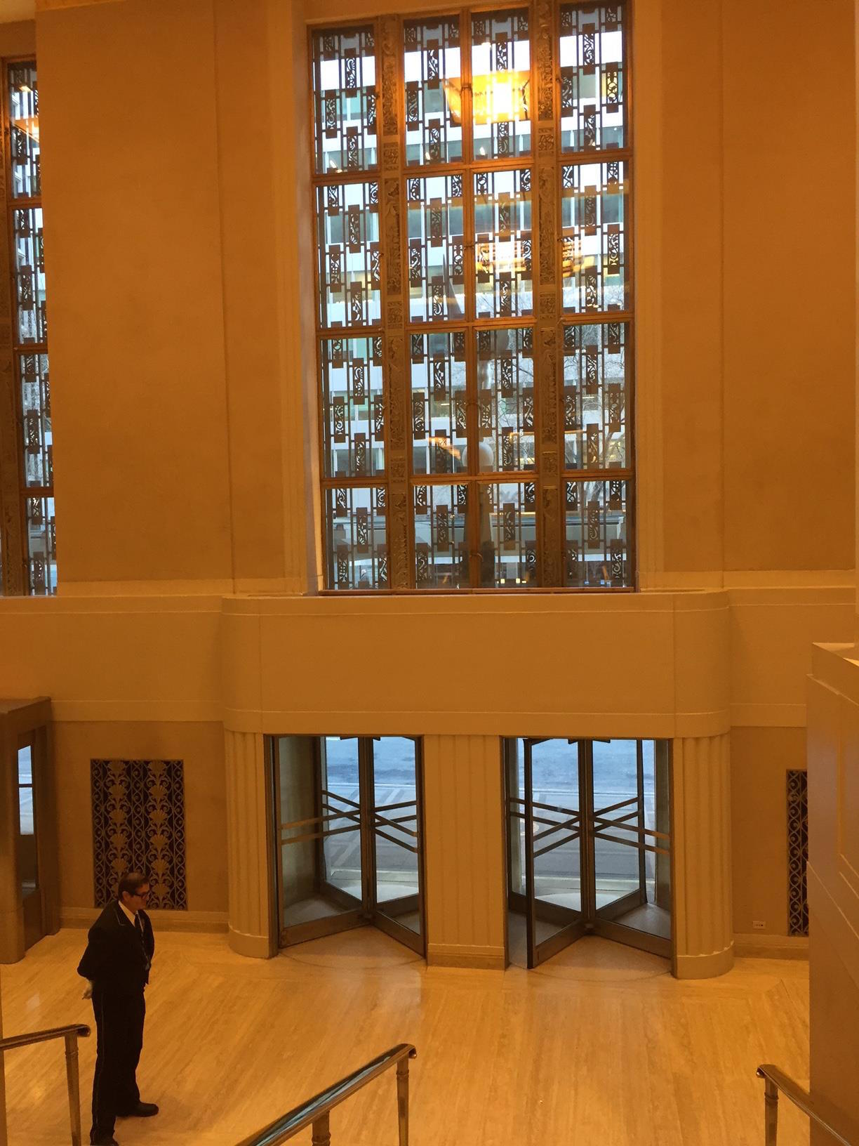
Saying Goodbye To The Waldorf-Astoria
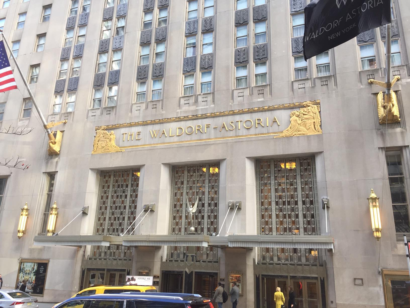
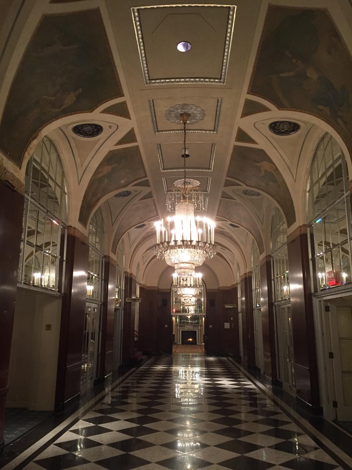
The Waldorf-Astoria is one of New York's most beautiful and historic hotels. It had been one of the popular stops on my Landmarks of Midtown tour. But this week I, and many New Yorkers, were visiting it for the purpose of saying goodbye.

This icon of midtown east is closing at the end of this month, for a multi-year reconstruction that will see most of its space converted into luxury condominiums. The Plaza Hotel went through a similar conversion several years ago. So while it will technically still exist, it won't be the same, and its gorgeous interiors no longer open to the public as they are now.

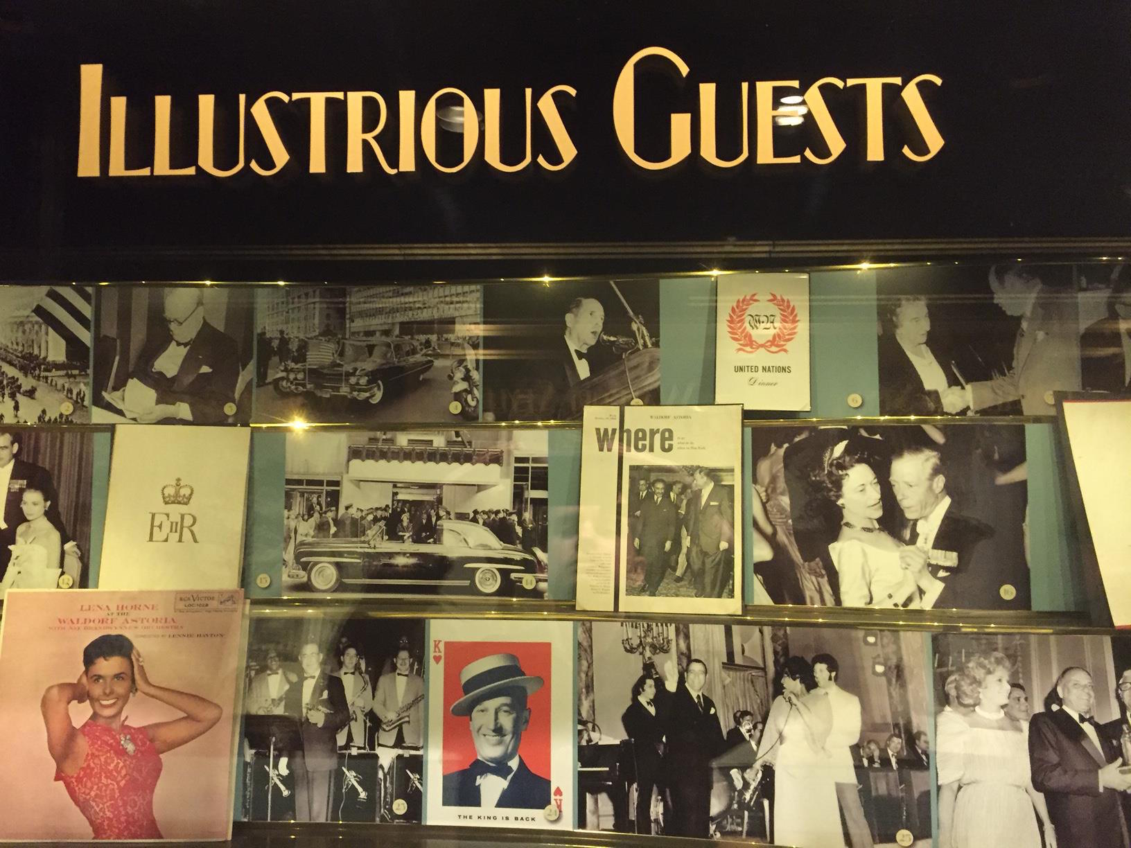
The Waldorf-Astoria has a storied past. It has hosted every single US President since Herbert Hoover (no other hotel can claim that), as well as celebrities and dignities from all over the world. Countless banquets and events have been held there. It has been featured in countless movies and TV shows.

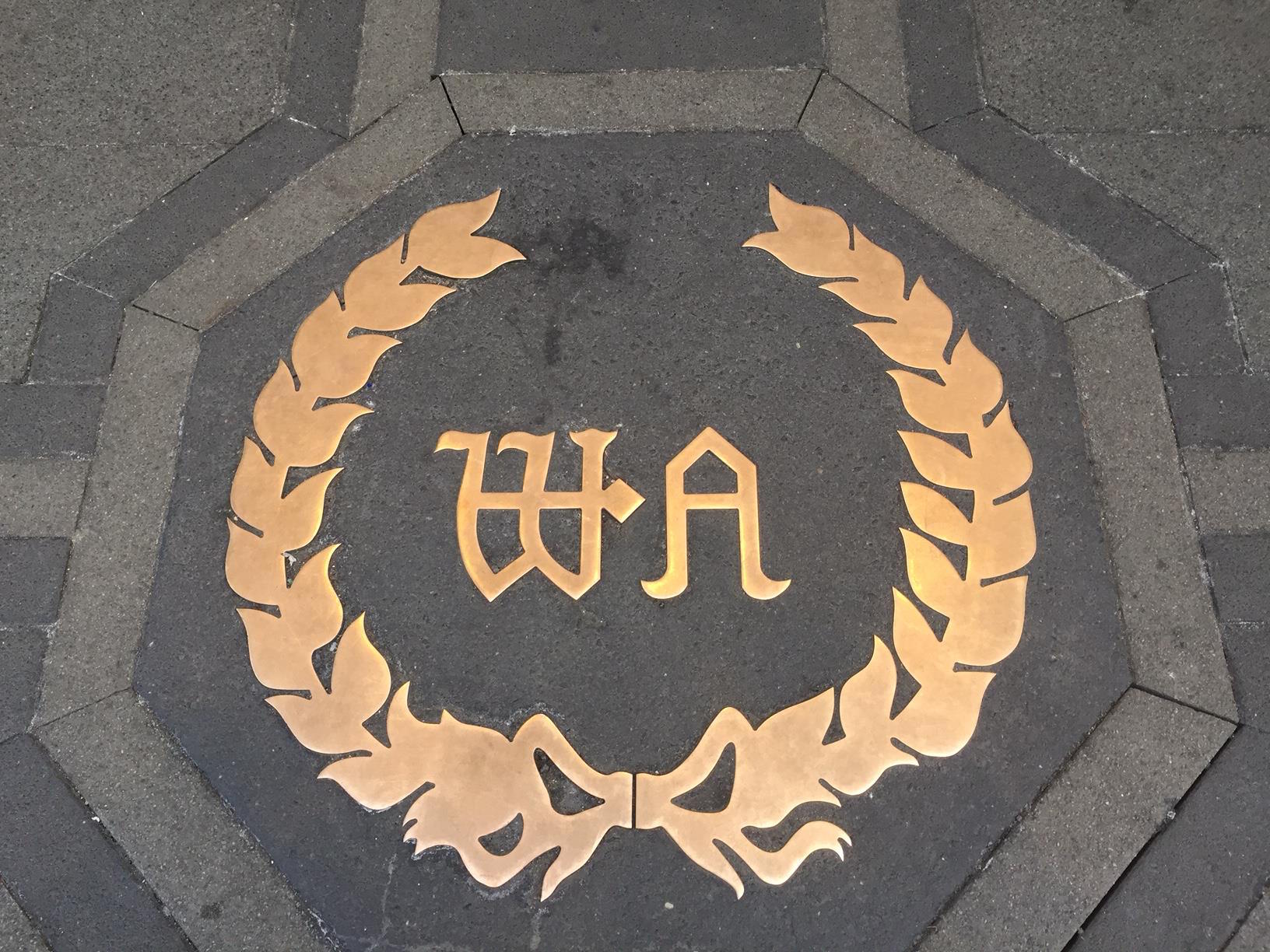
The famous duel name comes from two separate hotels housed a little further downtown, dating back to the late 1800s, where the Empire State Building stands today. William Waldorf Astor & John Jacob Astor IV (who were cousins!) owned two competing hotels right next to each other. The two eventually reconciled and connected their hotels via a walkway (dubbed "Peacock Alley"). The building was sold, and then demolished, to make way for the Empire State. The 'Waldorf-Astoria' name was sold to developer Lucius Boomer, who constructed a new hotel on Park Avenue 15 blocks north. When it opened, it was the largest & tallest hotel in the world. Its very name quickly evoked luxury and grandeur.

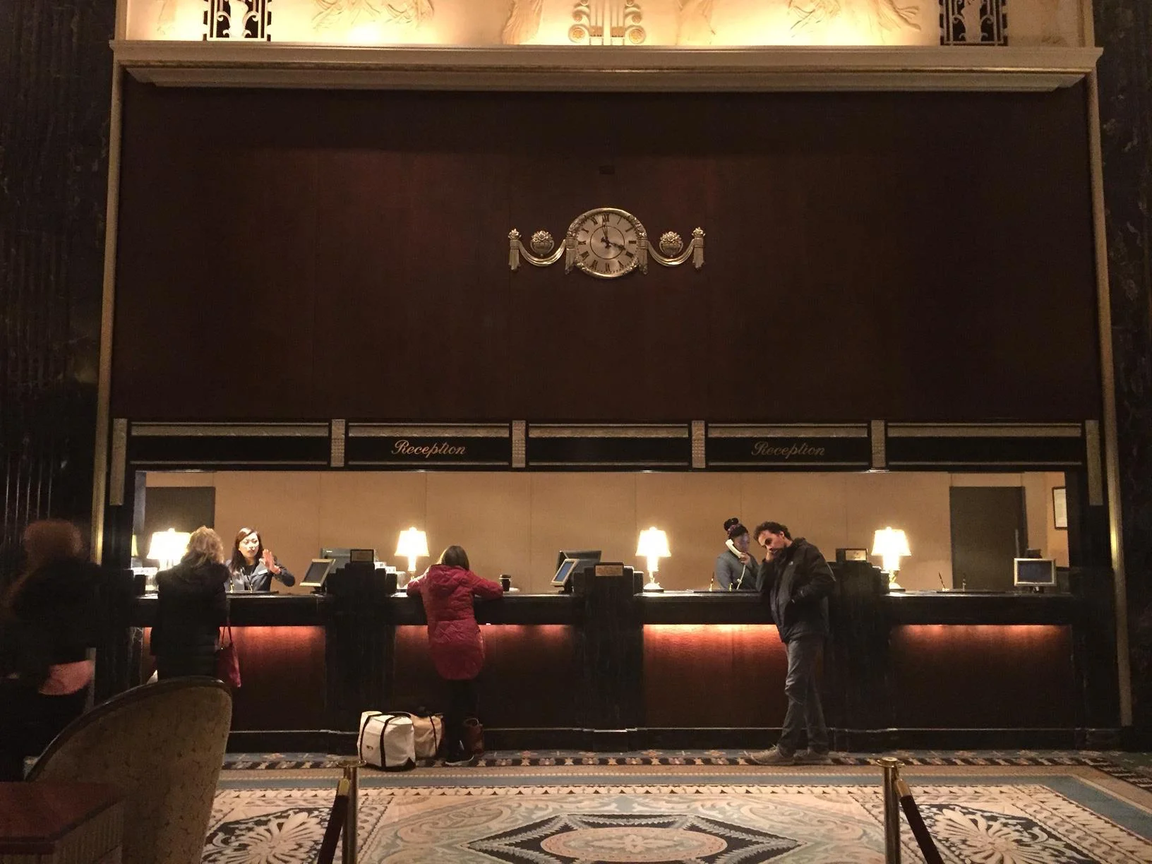
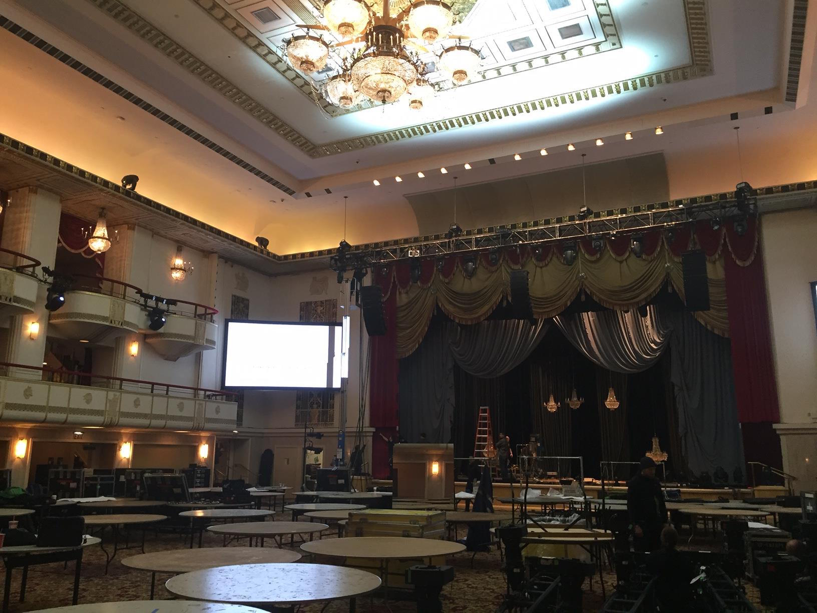
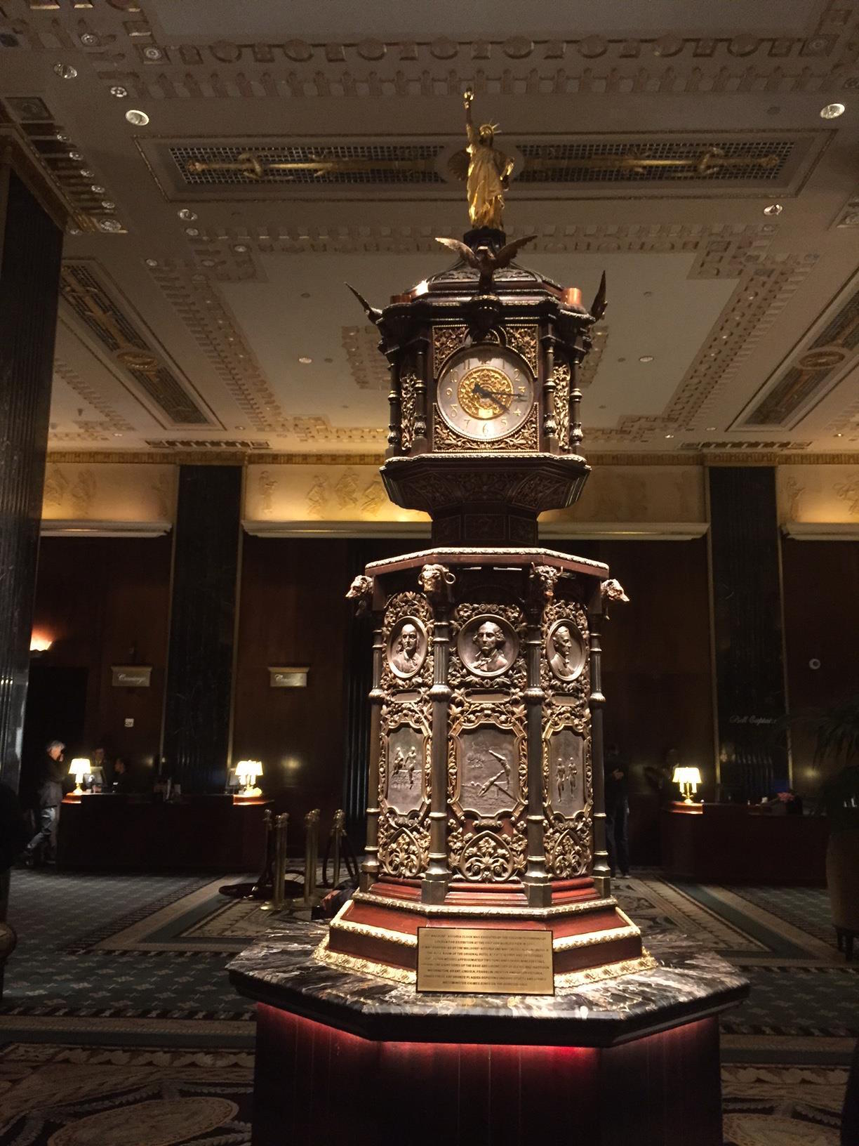
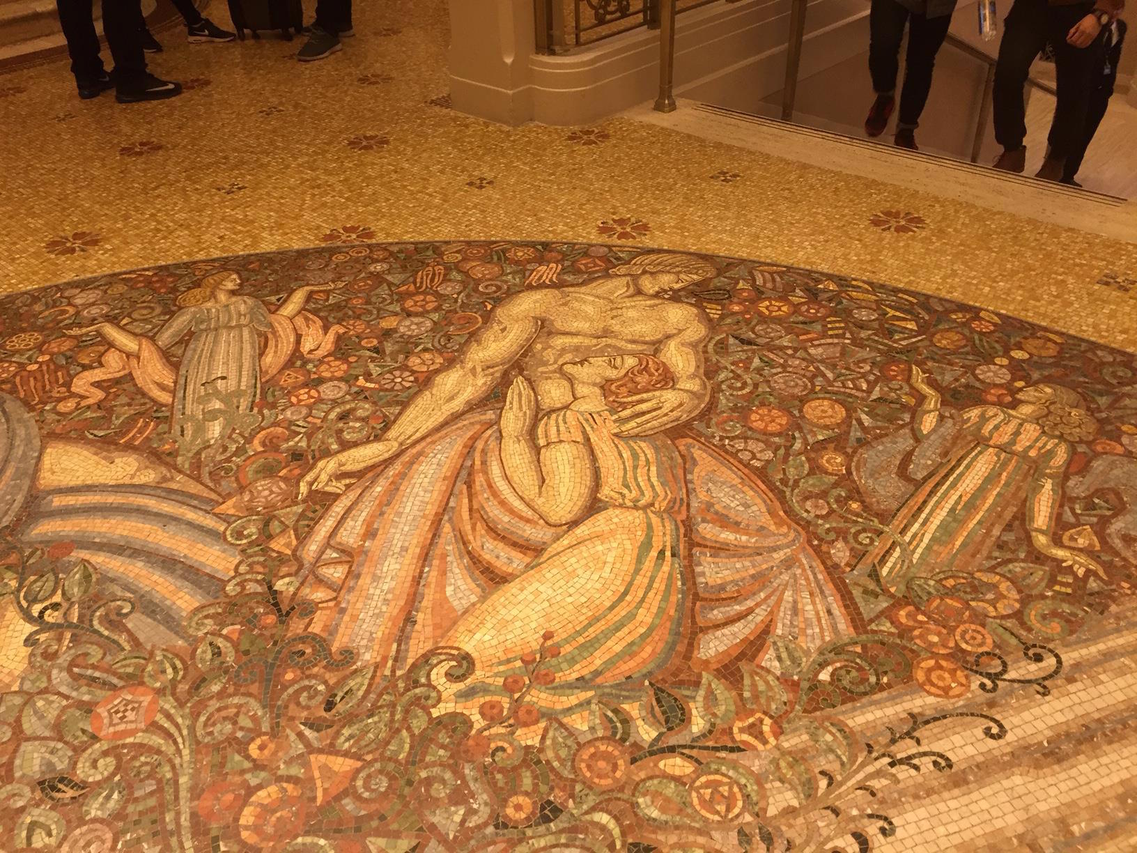
If you have time over the next day or two, I think it is worth it to head over and say goodbye to this Art Deco-era landmark. The staff have been incredibly open and accommodating to the many visitors who have come to take one final look. Or, if you can't, enjoy a sample below of some of the photos I took on today's exploration.

The Changing NYC Skyline: A Guide

New York City's skyline may be infamous, but it is never static. It has always changed (and risen!), and that is more true now than at any time since the 1930s. So I have decided to create this comprehensive guide to the most high-profile additions to Manhattan's skyline (not even factoring in all the development along the Brooklyn & Queens waterfront!).

Let's start with the most famous change... the new World Trade Center. Everyone knows One World Trade Center, the tallest building in North America (thankfully the rumored "Freedom Tower" name was abandoned). But the site consists of numerous other skyscrapers. The original WTC site had seven buildings. The new WTC was to have seven as well, but it was cut back to five. 1, 3, 4, & 7 are built (3 is just topping out this year), with 2 yet to come, in addition to a performing arts center.  In between all of these, of course, sits the memorial park and museum.

This is a rendering, not a photo. From left to right: One, Seven, 2, 3, and 4.

This is a rendering, not a photo. From left to right: One, Seven, 2, 3, and 4.

Next is the biggest addition to the skyline... literally. 432 Park Avenue, completed just over a year ago, topped out at 1,396 ft (425.5 m). You may have seen it while near Central Park; it is the very tall and thin behemoth towering over its puny neighbors. It is the second-tallest building in NYC (only One WTC is taller), and is currently the tallest residential in the world. Apartments here started at around $18M. Due to both its massive height, and thin frame, the window grid & interior space of 2 floors between every 12 occupied floors are left open to allow wind to pass through (to prevent swaying). It has become a controversial symbol of New York becoming, as former mayor Michael Bloomberg said, "a luxury product".

The next biggest change is still at foundation level. One block north of Grand Central Terminal, One Vanderbilt is just beginning to be built. When completed in a few years, it will be NYC's third-tallest building, at a height of 1,401 feet (427 m). As part of the project, developers are promising to add new access and connections to Grand Central.

Next up is another behemoth in early stages of construction... the so-called Central Park Tower (aka, the Nordstrom Tower), on W. 57th Street. At a proposed height of 1,550 feet (472m), it will be taller than 432 Park... though the latter will remain the tallest residential building, as this one will be mixed-use. It will be the tallest building by roof height in the US, surpassing Chicago's Willis Tower.

Rendering.

Rendering.

Moving over to the west side, we get to Hudson Yards, the most ambitious real estate development plan in NY since the original World Trade Center. Being built atop the Hudson rail yards, the city has billed this project as New York's "hottest new neighborhood". And it is indeed an entire neighborhood being built from scratch... over a dozen planned skyscrapers containing more than 12,700,000 square feet (1,180,000 m2) of office, residential, and retail space. The neighborhood will also feature new schools, parks, hotels, and restaurants. The project has already completed an extension of the 7 subway line to 34th St.

One architectural centerpiece will be a large public plaza featuring 'Vessel', which is being marketed as the Eiffel Tower of NYC. It will be a beehive-styled network of stairs, 16 stories in height.

Today, only a fraction of the project is completed.

Rendering

Rendering

Further down the adjacent High Line, there is more west side development, mostly high-end residential.

On the left, 520 West 28th St by the late Zaha Hadid (which will feature a $50M penthouse). On the right, the completed 10 Hudson Yards, now home to the offices of Coach and L'Oreal. The latter has a direct entrance from the High Line.

On the left, 520 West 28th St by the late Zaha Hadid (which will feature a $50M penthouse). On the right, the completed 10 Hudson Yards, now home to the offices of Coach and L'Oreal. The latter has a direct entrance from the High Line.

Walk a little south down the High Line, and you will soon see a new development at 76 Eleventh Avenue, by Bjarke Ingels. There will be two twisty condo towers, rising to 35 and 25 stories, respectively.

Rendering.

Rendering.

Further uptown, the Bjarke Ingels Group has already completed a major project, known as VIA 57 West. It sits right next to the West Side Highway. The building's design is referred to as a pyramid or a tetrahedron. It is a residential building rising 467 ft (142 m) and 35 stories tall. It has already won lots of architectural praise.

A little further east, near Columbus Circle, at W. 57th St & 8th Ave, is the Hearst Tower. Sitting atop the original Hearst HQ (completed in 1928), this decade-old skyscraper was designed by Norman Foster, best known for London's "Gherkin" tower.

Heading downtown now, we find a massive residential tower in trendy TriBeCa, which has already become an icon of the downtown skyline. 56 Leonard is a 821-ft (250 m) tall, 57-story condo building. Due to its unique shape, it has been dubbed by locals and the media as the "Jenga building".

Heading east from there, you will find New York by Gehry (aka, 8 Spruce Street), right near the East River. This 76-story skyscraper, Gehry's only other NYC work, was the world's tallest residential building upon completion, an honor that 432 Park uptown since took. As you enter the Brooklyn Bridge, turn around and you will see an amazing view of this building, along with the Woolworth Building and One World Trade Center.

In 10 years, the NYC skyline will likely change and grow even more exponentially.

Do you have any favorites among these new buildings? Or least favorites? Thoughts on the impacts these changes may have on the Big Apple? Share your opinions with me on social media... or contact me to plan custom walking tours of these sights!

The Legacy of Keith Haring

Keith Haring is one of the most famous street artists of all time. Even if you've never heard of him, odds are you've seen his work memorialized on clothing,  and other merchandise. He came from the same culture of "pop art" as Andy Warhol and others. Haring made a huge impact on the art world, despite dying at the far-too-young age of 31, in 1990.

Haring, in particular, left his mark on the street art in scene in NYC, and was one of the first to elevate the underground, illegal graffiti culture into something popular and mainstream. His most lasting NYC legacy is the Bowery Mural, a large wall on the corner of The Bowery & Houston Street. In 1982, he put a huge mural on the wall on that corner. He made the corner famous. Though that work is long-gone, that wall had become synonymous with art, and as the ownership of the building changed hands, and development grew around it, it was understood that the wall would need to remain a canvas for NYC's street artists. New murals now are painted on that wall seasonally.

However, one famous Haring piece in NYC remains. In 1986, Haring went to a random playground in east Harlem, and painted two murals, one on each side of a handball wall, to highlight the need to fight that era's crack epidemic. Not for the first time, Haring was arrested for vandalism. But the public and the press rallied around him, and he was let off with only a $100 fine. After the piece was itself vandalized, the Parks Dept asked Haring to come back and officially re-create his "Crack is Wack" mural. He did, and it remains today. It became so popular, that, after his death, the city officially renamed the entire playground the Crack Is Wack Playground.

And Haring's legacy remains on every other wall in NYC where street artists look to make their mark, and create a legitimacy to this form of art.

Taking The Subway

Occasionally, on my tours, I'll give a customer directions from a tour's end spot to their next plans, via the subway, and they are hesitant. Whether it's a mix of fear of the unfamiliar, safety concerns, or just a preference of the private comfort of a cab, I do sympathize.

But here's my professional opinion on why tourists should use the subway to get around:

  1. It's reliable! Our system is unique in the world, in that it runs 24/7. Short of a natural disaster, the trains never stop running. Don't risk getting stuck in traffic, or with a cab driver who doesn't know where you're going. Google maps offer public transit directions now... find the best/closest route, and get there fast.
  2. It's inexpensive! For $2.75, you get into the system, no matter how far you're going, transfer included. No fare zones. One ride, one fare. Plus discount fares for seniors, kids 44" or shorter are free.
  3. It's safe! Subway crime has remained on a steady decline over the last 30 years.
  4. Travel like a local! Everyone from construction workers to janitors to Wall St traders ride the subway. It's our city's great underground melting pot. You haven't experienced NYC until you've become a straphanger.
  5. It's an art scene! The MTA has an official arts program, that helps design station walls with beautiful art pieces, murals, and musicians. Each station is unique.

So there's my pitch.

And now, some tips!

  1. Grab or download a subway map (my favorite app: Exit Strategy). Know your routes, and plan your travel in advance. And, as noted before, you can get updated directions via Google Maps now.
  2. Check the MTA website before you go, particularly on nights & weekends... as off-peak repairs do cause trains to be re-routed or temporary service suspensions.
  3. Your best mass transit route to JFK from midtown: Take the LIRR (Long Island RailRoad)-- buy a ticket in advance at Penn Station!-- to Jamaica and take the AirTrain. This is the quickest way. To save some money, just take a Queens-bound E train to Jamaica instead for your AirTrain transfer. The AirTrain is $5 and stops at every terminal. Going to LaGuardia... well, the city's still figuring that out.

The High Line's Final Spur

Many people know the story of the High Line (if not, learn it on my tour!)... a former freight rail line, abandoned for decades, reborn as NYC's "park in the sky". But the story continues.

Since the High Line park first opened in 2009, it has only continued to grow. A second phase opened in 2011, and a third phase (extending the park to Hudson Railyards section) opened in 2014. But the park is still not yet complete. There is a final spur, running off the railyards end, that runs along West 30th St toward 10th Avenue. Work on that section had to put on hold while the 10 Hudson Yards skyscraper went up next door. But with that completed, the High Line can finally complete this spur.

The park has begun putting up banners previewing their plans:

So what do you think? As a visitor or a local, will this expansion make you more likely to come back?

Staten Island: The Fifth Wheel of NYC?

On an average weekday, around 66,000 riders, many of them tourists, board the (free) Staten Island ferry, which connects lower Manhattan to NYC's most isolated borough. For the tourists, once the boat arrives at St George Terminal in Staten Island, they exit, and then immediately queue back up for the return boat to Manhattan.  This is a conundrum that has vexed Staten Island officials for years. People are arriving at their shore by the (literal) boatload, but never go farther than the terminal. How do they get them outside?

The city's northernmost borough, and the only one connected to the mainland, the Bronx, at least has Yankee Stadium, the New York Botanical Garden, and the Bronx Zoo to draw in tourists, plus some other treasures (more than most think!). What does its southernmost borough have to sell to tourists?

The Staten Island faithful would be happy to tell you: Snug Harbor Cultural Center & Botanical Garden, historic Fort Wadsworth, the Lighthouse Museum, and more. But, as of now, that is not enough to draw tourists. So politicians have two big projects in the works to up the borough's profile.

The first, and more high-profile, is the New York Wheel. Observation wheels have been a huge economic boon to cities-- most famously, the London Eye-- and Staten Island is building one that will dwarf its predecessors (630-ft/192.0-m tall to the 443-ft/135-m of its London counterpart). A single rotation will accommodate up to 1,440 riders.

It is part of a large project for the waterfront that will also include the Empire Outlets retail complex. It is scheduled to open in Spring of next year... though that date has been bumped back already due to construction delays.

Will you travel to Staten Island to ride this?

Will you travel to Staten Island to ride this?

Further inland, a perhaps even more ambitious project is coming along.

Staten Island was once most famous for the Fresh Kills landfill, which for decades operated as the principal landfill for NYC's garbage. Covering over 2,200 acres (890 ha), it was once the largest landfill, as well as human-made structure, in the entire world. Urban legends even persisted, though false, that it was so large it was visible from space. And boy, did it smell lovely!

The landfill was closed in March 2001, but temporarily reopened later that year as a sorting ground for a large amount of the rubble from the World Trade Center. But it has not taken in garbage since.

Proposals to reclaim the site had floated around for years. But starting in 2008, work finally began on Freshkills Park project... a decades-long plan to convert the site into a massive park, 3x the size of Central Park. Although the entire park is not scheduled for completion until 2037 (!!), a lot of work has been done already, and it is now home to hundreds of species and plants and animals. The space opens up several times a year for open-house "discovery days" with other special tours (for kayaking, birding, etc) planning throughout each year.

I had the pleasure of visiting during a discover day this past summer, and found the park stunning. While I am skeptical that it will draw many tourists to the island, it already is an amazing resource for the city. A triumph of engineering.

(If you are curious about the process of converting a toxic landfill into a park and wildlife refuge, there's a great article on how they did it on the Smithsonian website.)

So, after decades of being in the shadows of the other four boroughs, Staten Island is preparing for its big coming out. What do you think? Do you think visitors will be adding the island to their NYC to-do lists?

Photo Contest!

As you have seen, I love taking lots of photos when I travel, or even just here at home in New York. And I follow some amazing people on Instagram, so I know there's lots of people taking gorgeous photos of New York City.

So I've decided to organize a photo contest for the other travel photographers out there. If you have interesting, unique, fun NYC photos that you've taken, please share them with us. You can share 3 ways:

  1.  Post directly to our Facebook page
  2. Post on your Instagram and tag our account
  3. Post on Twitter & mention/tag our account

I will then pick my favorites and then will put the finalists up to a public vote. The contest will run through the end of this month (February 28). The winner will be notified shortly thereafter. The winner will receive a NYC prize package which includes:

  • Guest pass to Mu$eum of American Finance (free admission for 2)
  • Family pass to The Skyscraper Museum (free admission for 5)
  • 2 guest passes to The Brooklyn Strategist
  • $25 gift card to Nitehawk Cinema
  • Gift certificate to Custom NYC Tours (free tour of your choosing, up to 6 people)

Looking forward to seeing the entries! If there any questions, please contact me!


Welcome To My Blog!

For any new readers... welcome!

I started this blog to not only promote my tours, or upcoming events, but to share my stories of New York City. For those who are new visitors, here are some of my previous entries I like best:

  • Is It Safe?: A look on discussions of NYC safety with my customers, and how '70s/'80s pop culture has cemented an outdated narrative of our city.
  • The 1964 World's Fair... Presented by Walt Disney?: A history lesson, with classic photos & video, combining two of my favorite things... Disney theme parks, and the 1964 World's Fair that was held in Queens.
  • The Second Avenue Subway: A history of the Upper East Side subway line delayed nearly a century, just now finally coming to fruition.
  • A Tour Grows In Brooklyn: The process of creating a custom tour of Bensonhurst, Brooklyn, in December, for a former resident of the neighborhood who wanted to re-learn the history of his childhood home.
  • I Love a Good Challenge: My love of contests that get me to travel around the city.
  • Street Art: An explanation of what "street art" is, how it relates to (and differs from) graffiti, and why it's more central to NYC culture than you realized.

I also want to use this blog to start a conversation. Are you a local? Or an upcoming traveler? Ask me questions, ask for advice, or share your stories! I want to hear from you.

Requiem For The Troll Museum

New York City is known around the world for its peerless museums... The Metropolitan Museum of Art, MoMA, the Guggenheim, and countless more. But it also houses many lesser-known, eclectic museums.

Venture into a Chinatown alley and see Mmuseumm, the city's smallest museum, housed entirely in a freight elevator. Or go to Williamsburg and visit the City Reliquary, housed in a former bodega and featuring unique artifacts from NYC history. In SoHo, you can view the New York Earth Room,  a single room filled with 280,000 pounds of dirt. And let's not forget the Museum of Sex, in midtown.

Alas, NYC is losing many of these treasures. Brooklyn recently lost its Morbid Anatomy Museum. And last year, we also lost my personal favorite... The Troll Museum, a labor of love by local performance artist Reverend Jen Miller. Housed in her Lower East Side tenement, the "museum" consisted of Miller's well-curated collection of troll dolls and related memorabilia. She had hundreds of pieces in the collection. But last summer, Miller was evicted from her apartment, and thus the museum was no more.

I had the pleasure of speaking with Miller a couple of years ago, and arranging a private visit to her home/museum. To see this in person was breathtaking.

Rev. Jen Miller was not just a hardcore collector (and a true NYC character!), she was also an amazing storyteller. She regaled me with the history of troll dolls, and went shelf-by-shelf to explain the significance of everything. She took one room full of dolls and turned it into a thorough, memorable one-hour tour. Her presence in the Lower East Side is missed every day.

So don't wait to experience the unique museums and experiences that New York City has to offer. They might not be here for long!

In the meantime, you can take this virtual tour of The Troll Museum, from 11 years ago:

QueensWay, or No Way?

Many people in NYC (okay, just central Queens) are familiar with the long-abandoned Rockaway Beach Branch of the Long Island Rail Road (LIRR), an amazing stretch of track that runs all the way from Rego Park down to South Ozone Park. It has come into spotlight in recent years due to two competing visions: proposals for a greenway/linear park called the QueensWay-- inspired by the success of urban rail-to-trail projects such as the High Line-- and transit advocates who want some sort of rail rebuilt (varying from LIRR ‘reactivation’ to a massive project of subway conversion involving tunneling under Rego Park and connecting to the Queens Blvd subway line). In the meantime, it is (largely) a forest.

My fascination with it began growing up in South Ozone Park. As the Manhattan-bound A trains neared the Rockaway Blvd station, a large scrap-metal spider could be seen hanging on part of the abandoned line (it has since fallen, and decayed). An image of the spider in its heyday can be seen on an Angelfire site, where you can also scroll through to find images showing the line as it stood around a decade ago. Despite spending most of my life in Queens, I had never set foot on it, however. I since changed that, with several visits in the past few years.

This blog post will be a mix of sharing my own walks and images, along with some subsequent research I did to answer the questions that arose along the way.

First, let’s orient ourselves via map. The following shows you where the northern end broke off from the main LIRR line, shortly before the Forest Hills stop.

I entered the trail near there, right off of Fleet St, where it can be accessed inside a ball field, and I headed south. This end was the most overgrown, and was almost impossible to pass in some areas. Being in shape and limber is recommended (and absolutely not recommended in wet or humid weather conditions).

It wasn’t until I got past Metropolitan Avenue that I hit a big question mark… and a literal dead end.

It was then that I realized that this track was not as 'linear’ as it is often described.

The bridge where the line once crossed the (lower, and still semi-in-use) Lower Montauk LIRR line is completely gone… collapsed, or removed, I could not determine.

Let’s look at this point via (again) map.

I climbed down the hill onto and across the Montauk tracks where you see this:


More questions arose on the other side here, where there was no more track to follow. Beyond the above trestle, there was only a parking lot. Where’d the QueensWay go? 

Just to the (west) side of this lot, however, I found another set of tracks, which curved west toward the Montauk tracks, but from there did head south. Was what we think of as one linear path actually TWO separate lines? Yes, and no.

Just ahead, where the tracks cross over Union Turnpike, it starts to get a little clearer. Here, I found two bridges, where the two lines began to come close (but not yet intersect).

The above image was taken from the bridge of the rail that came from the Montauk tracks looking east at the bridge of the rail that came south from Rego Park. (Make sense?)

Let’s get a overall picture of how this works, via satellite map.

Above, you can see where the “right of way” from the Rego Park line now is gone, and has been taken over by a parking lot, and where the stretch coming from the Montauk line runs adjacent to a small ball field. The two dark red/brown lines over Union Tpke represent the two bridges. Across the western one, the line peters out into a parking lot of an apartment complex.

The “?” I added in the previous satellite map grab shows where the two lines met, and where the rail line picks back up again, at the entrance to Forest Park.

Now let’s a break from my journey to fill in some of these blanks. After I returned home, I looked up the Wikipedia page for the Rockaway Beach Branch, and found my answers. The page notes: “Steam trains continued to serve Rockaway Park from Long Island City [the Montauk line] until June 16, 1910, when the electrified Glendale Cut-off opened, extending the line north from Glendale on the Montauk Division to White Pot Junction at Rego Park on the Main Line.”

So the two lines were together from the Rockaways north to Glendale, where they separated just south of Union Tpke. In short, a lot more complicated than either side discusses in their simplified history of the line.

Back to the journey! 

The section of the park that runs through Forest Park is the smoothest, least forest-y (and most easily accessible) area, and is therefore the one I’d recommend for anyone who wanted to see this, but isn’t up to a deep forest hike.

At the end of Forest Park, over Park Lane South, fencing was put up to block the overpass bridge, but large holes have been cut through by others to make passage easy. Past there is where it starts to get wild again, and where you start to notice, as the Wiki page notes, “A number of properties adjacent to the right-of-way have expanded their property fences over sections of the former right-of-way, without acquiring the rights to the land”. Oop. Close to Atlantic Avenue is where I headed out, as a look further south seemed to indicate further passage would be quite difficult. 

Map-wise, here’s where it runs south of the park.

And with satellite image mode:


(That tree line provides a helpful illustration, no?)

After bailing from the trail, I continued on foot on street level alongside the railway to continue my journey.

(See? Impassable. I’d never to get touch those spider remains.)

Right over here, at Atlantic Avenue, the entrance to the former Atlantic Ave station is fenced off.

Right south of Atlantic, I noticed something curious up there… school buses?

How’d they get there? And how do they get down every day? Once again, the Wiki entry provided my answers: “The line’s connection with the Atlantic Branch at Woodhaven Junction, consisting of an interlocking, tunnel portal and incline that rose to meet the elevated Rockaway Branch, was closed and removed in October 1955. This connection had primarily been used to allow trains from Brooklyn to reach Aqueduct Racetrack. The remains of the interlocking can still be seen in the Atlantic Avenue tunnel, while the incline is now used by Logan School Bus Company, who parks their bus fleet along the incline.”

Here is a link to what remains of that incline.

And here’s what that bus lot looks like via satellite.

Soon after this point, my journey came to an end on Liberty Avenue, where the Rockaway Beach Branch meets up with the Rockaway-bound A line heading south. From Liberty, I was able to capture an image of the spider’s carcass. RIP, little guy.

I hope that this post was able to help shed some light on the Rockaway Beach Branch/QueensWay/etc, which it turns out most people don’t know that much about, myself included prior to these explorations.

Regarding the debate between park versus rail, a few of my personal opinions: I (mostly) side with the park crowd, as I feel that re-drawing Woodhaven Blvd with dedicated bus lanes and adding Select Bus Service could alleviate a lot of transit issues… and could be done in the very near future at (relatively) low cost. With the Second Avenue subway (now in its 9th? decade of planning), East Side Access for LIRR, Fulton Center, etc, the MTA has proved it is no longer capable of doing big ideas remotely on time or in budget. Queens residents can’t pin their transit hopes on a fantasy that this is not the case. Yes, this area could benefit from more rail. But look a subway map of Queens. Most of it is a subway dead zone. This area is less-so than most, actually. And finally, let’s be real… as the Wiki entry notes, most residents don’t want rail in their 'backyards’. Or a park. They want the status quo. NIMBY, literally.

Until you can fight that, the forest remains.

International Tourist Guides Day

International Tourist Guides Day is an annual initiative of the World Federation of Tourist Guide Associations (WFTGA), every year on February 21. It is a tradition on this day for guides to give complimentary tours to promote our industry.

I have chosen to participate this year with a special, half-hour walking tour in downtown Manhattan (please RSVP at the link if interested). This tour will take us through the interconnected, underground passageways that run under Fulton St in downtown Manhattan, starting at the Fulton Center subway station, running through the World Trade Center transportation hub, and ending at Brookfield Place. The aim of the tour is to show visitors the rebirth of downtown through its transit initiatives.

If you can't make it that day, feel free to contact me for other tour options!

New Tour: Lower East Side Street Art!

I have lots of great things planned this year, including several new tours. I have just added the first: a street art tour through the Lower East Side! This a Manhattan counterpart to my popular street art tour in Brooklyn.

This tour will be a fun one, not only for street art enthusiasts, but also for those who want to explore the historical and eclectic Lower East Side. Availability starts in a couple weeks, but booking is open now. I look forward to seeing your soon!

Come Home to New York!

Like many of NYC's finest tour guides, I am a member of the Guides Association of NYC (GANYC), and also work for their PR committee. GANYC is in the process of bidding to get New York to host the 2019 convention for the World Federation of Tourist Guide Associations (WFTGA). The United States has never been a host country for this convention before.

Here is the video that was created to make this pitch, as well to generally help sell our wonderful city and the importance of having a guide by your side. Yours truly has a small cameo when the tour bus makes it way over the Manhattan Bridge.

The concept is that, no matter where you are from, there is a little slice of home in NYC. Come home to New York!